£0.00 - 0 items View Basket

2024 Croatia + Bosnia Herzegovina VFR Chart 1:500 000 - Rogersdata

Pooleys stock code: ICH550

2024 Croatia + Bosnia Herzegovina VFR Chart 1:500 000 - RogersdataImage Id:179201
2024 Croatia + Bosnia Herzegovina VFR Chart 1:500 000 - RogersdataImage Id:126807
2024 Croatia + Bosnia Herzegovina VFR Chart 1:500 000 - RogersdataImage Id:126811
2024 Croatia + Bosnia Herzegovina VFR Chart 1:500 000 - RogersdataImage Id:126810
2024 Croatia + Bosnia Herzegovina VFR Chart 1:500 000 - RogersdataImage Id:126809
2024 Croatia + Bosnia Herzegovina VFR Chart 1:500 000 - RogersdataImage Id:126808
2024 Croatia + Bosnia Herzegovina VFR Chart 1:500 000 - RogersdataImage Id:126806
2024 Croatia + Bosnia Herzegovina VFR Chart 1:500 000 - RogersdataImage Id:126804
2024 Croatia + Bosnia Herzegovina VFR Chart 1:500 000 - RogersdataImage Id:126805
2024 Croatia + Bosnia Herzegovina VFR Chart 1:500 000 - RogersdataImage Id:126803
2024 Croatia + Bosnia Herzegovina VFR Chart 1:500 000 - RogersdataImage Id:126802
2024 Croatia + Bosnia Herzegovina VFR Chart 1:500 000 - RogersdataImage Id:126801
2024 Croatia + Bosnia Herzegovina VFR Chart 1:500 000 - RogersdataImage Id:126798
2024 Croatia + Bosnia Herzegovina VFR Chart 1:500 000 - RogersdataImage Id:126799
2024 Croatia + Bosnia Herzegovina VFR Chart 1:500 000 - RogersdataImage Id:48047

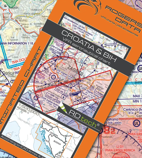
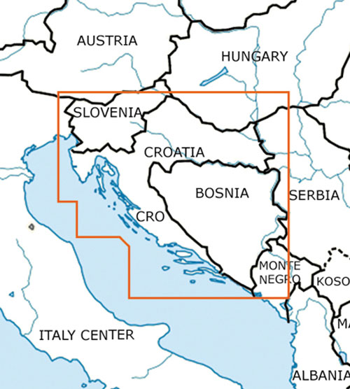
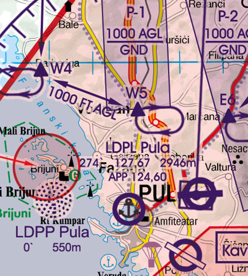
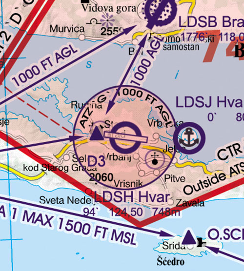
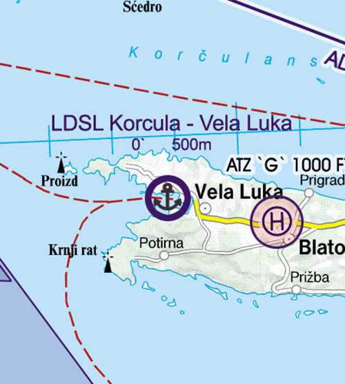
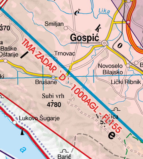
2024 Croatia & BIH VFR aeronautical chart – ICAO chart 500k

Special features for this region:

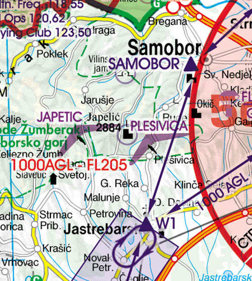
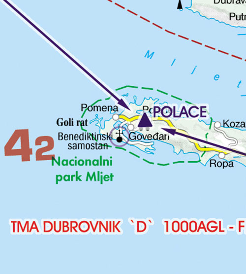
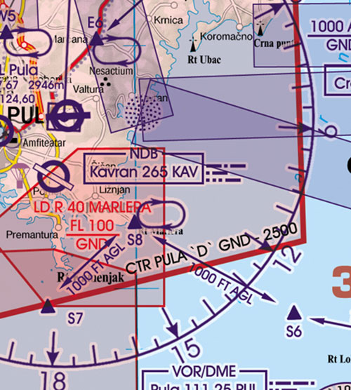
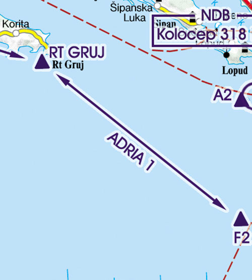
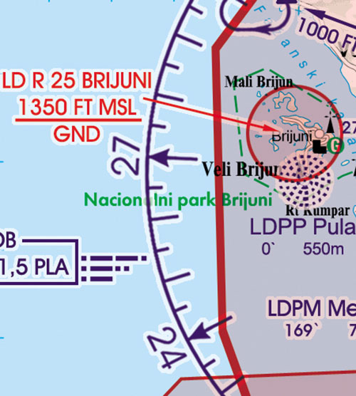
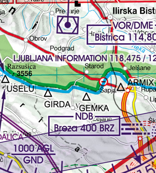
  • Recommended VFR Routes
  • Water aerodromes
  • Aerial sporting and recreational activities
  • Areas with sensitive fauna
  • Low level military flight corridors and training areas
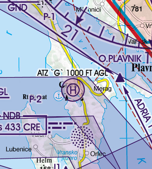
  • ATZ aerodrome traffic zone
  • Significant points (border crossing points).

All Rogers Data VFR charts 500k are designed to the following criteria:

  • Aeronautical chart on a scale of 1:500.000
  • According to ICAO Annex 4; EU-Commission Regulations; AIP
  • Clear representation of the ATS airspace structure
  • Detailed highly sophisticated terrain map with shading and relief
  • Airports, aerodromes and heliports with additional information
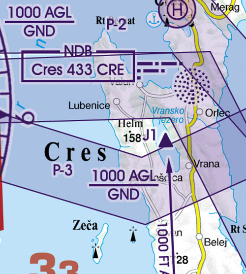
  • Radio Navigation Aids with name, frequency and morse code
  • Compulsory reporting points, reporting points on request, significant points (border crossing)
  • Prohibited, danger- and restricted areas
  • Obstacles or group of obstacles
  • Minimum Grid Area Altitude
  • Isogonic line model with magnetic variation
  • With the Rogers Data navigation compass 500, track, time and distance in the scale of 1:500.000 can be easily measured.


£25.95 £25.95 inc. VAT (Exempt)*


Share this product:


Pooleys Retail Catalogue Winter/Spring Edition 2024

Pooleys Retail Catalogue Winter/Spring Edition 2024

To order your FREE copy of the latest Pooleys Retail Catalogue Winter/Spring Edition 2024 please click on the image above or link below.

Order a copy

International Dawn to Dusk Competition - sponsored by Pooleys

International Dawn to Dusk Competition - sponsored by Pooleys

The International Dawn to Dusk Competition, now in its 60th year, provides a unique aeronautical challenge participating in a day's flying using an aircraft of the competitor's choice.

Learn more

Pooleys Charitable Support

Pooleys Charitable Support

At Pooleys, we believe strongly in giving back to the aviation community and giving those who would not ordinarily have the opportunity to experience flight, the ability to realise their dreams.

View the Charities & Groups we support

© 2024 Pooleys Flight Equipment.
All rights reserved.


Website design: