£0.00 - 0 items View Basket

European Aerodromes South – Panorama Chart 1:2.500.000, 2017-2020 - Rogersdata

Pooleys stock code: ICH559

European Aerodromes South – Panorama Chart 1:2.500.000, 2017-2020  - RogersdataImage Id:128034
European Aerodromes South – Panorama Chart 1:2.500.000, 2017-2020  - RogersdataImage Id:128028
European Aerodromes South – Panorama Chart 1:2.500.000, 2017-2020  - RogersdataImage Id:128031
European Aerodromes South – Panorama Chart 1:2.500.000, 2017-2020  - RogersdataImage Id:128032
European Aerodromes South – Panorama Chart 1:2.500.000, 2017-2020  - RogersdataImage Id:128033
European Aerodromes South – Panorama Chart 1:2.500.000, 2017-2020  - RogersdataImage Id:128030
European Aerodromes South – Panorama Chart 1:2.500.000, 2017-2020  - RogersdataImage Id:128029

European Aerodromes South – Panorama Chart 2.500k 2017-2020

  • Panorama map on a scale of 1:2.500.000
  • Aerodromes with ICAO code
  • Colourful and accurate
  • Urban areas
  • International borders
  • VFR an IFR aerodromes
  • Civil- and military aerodromes

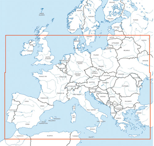
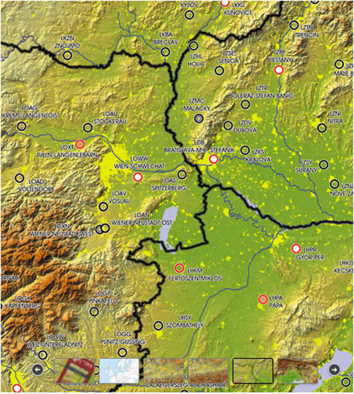
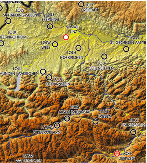
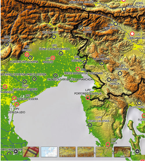
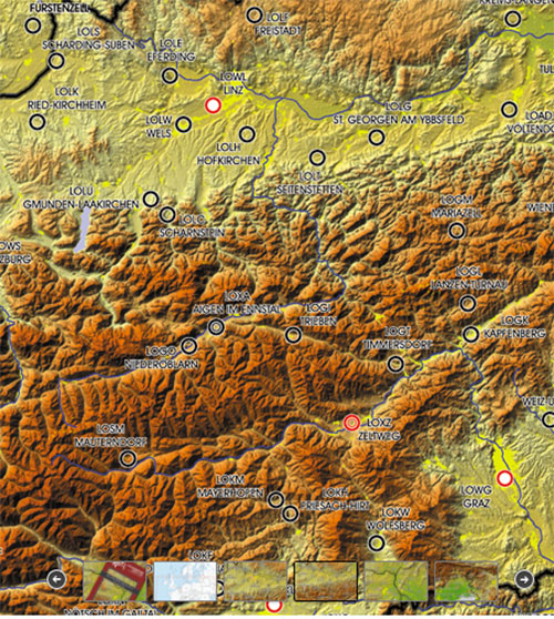
The Europe Wall Chart is an ideal chart for preparing flights to European destinations or alternates and calculating flight times, ranges and radius of action. It shows european aerodromes and contains important topographical information.

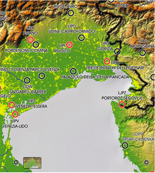
Colorful and accurate, these maps clearly depict international boundaries, major cities and towns, rivers, lakes, mountain ranges. Also listed are major airports and aerodromes. This map is great for pilots and aviation enthusiasts alike.

This extremely detailed map includes hundreds of airports both civil and military, IFR and VFR. Ideal to get an overview for preliminary flight planning and makes a great wall poster! Urban areas, terrain contours, topographical features including bodies of water and more. „European Aerodromes Rogers Data 2.500k“ uses a scale of 1:2.500.000.

Whether you’re a captain of a jumbo jet, a passenger on their first flight, or anything in between, this map and shown information has something for you! There are 2 map sheets (north and south), in the middle you can stick those ones together. Perfect for School- and Flight preparation-rooms or for your home.

Measures B98 x H136 centimetres.


£31.75 £31.75 inc. VAT (Exempt)*


Share this product:


Related products

European Aerodromes North – Panorama Chart 1:2.500.000, 2017-2020 - Rogersdata

£31.75

£31.75 inc. VAT (Exempt)

View Product

Pilots Atlas - Europe (4th Edition)

£25.95

£25.95 inc. VAT (Exempt)

View Product

Air Million Edition 2024 – Central Europe, Germany, Czech Republic, Netherlands & East Of Poland

£18.25

£18.25 inc. VAT (Exempt)

View Product

Air Million Edition 2024 – Eastern Europe, Bosnia, Bulgaria, Hungary, Moldova, Romania, Serbia and Slovakia

£18.25

£18.25 inc. VAT (Exempt)

View Product

Pooleys Retail Catalogue Winter/Spring Edition 2024

Pooleys Retail Catalogue Winter/Spring Edition 2024

To order your FREE copy of the latest Pooleys Retail Catalogue Winter/Spring Edition 2024 please click on the image above or link below.

Order a copy

International Dawn to Dusk Competition - sponsored by Pooleys

International Dawn to Dusk Competition - sponsored by Pooleys

The International Dawn to Dusk Competition, now in its 60th year, provides a unique aeronautical challenge participating in a day's flying using an aircraft of the competitor's choice.

Learn more

Pooleys Charitable Support

Pooleys Charitable Support

At Pooleys, we believe strongly in giving back to the aviation community and giving those who would not ordinarily have the opportunity to experience flight, the ability to realise their dreams.

View the Charities & Groups we support

© 2024 Pooleys Flight Equipment.
All rights reserved.


Website design: