Our products
- Airband Transceivers / Scanners / Radios
- Aircraft Checklists & Guides
- Aircraft Cockpit Accessories
- Aircraft Cleaning
- Aircraft Equipment and Operations
- Aircraft Maintenance including Oils & Fluids
- ATPL / CPL Training Materials
- PPL Training Material & Starter Kits
- Flying Schools & Instructors
- Avionics / GPS / ADS-B
- Books, eBooks, Manuals & Resources
- Cameras
- CD / DVD / USB & Online Courses
- Charts - United Kingdom
-
Charts - Europe
- European Atlas and Wall Charts
- Austria
- Belgium/Luxembourg
- Bosnia & Herzigovina
- Bulgaria
- Chart Accessories
- Croatia
- Czech Republic & Slovak Republic
- Denmark
- Estonia
- Finland
- France
- Germany
- Greece
- Hungary
- Iceland
- Ireland
- Italy
- Latvia
- Lithuania
- Malta & Sicily
- Netherlands
- Norway
- Poland
- Portugal
- Romania
- Serbia
- Slovakia
- Slovenia
- Spain
- Sweden
- Switzerland
- Turkey
- Charts - Rest of the World
- Charts - by Brand
- Flight Guides & Trip Kits
- Flight Simulation
- GIFTS
- Headsets & Accessories
- Log Books and Licence Holders
- Navigation Device Mounts
- Navigation Equipment
- Pilot Bags & Cases
- Pilot's Clothing & Uniforms
- Pilot's Flightboards - A4
- Pilot's Kneeboards - A5 and Phones
- Pooleys Flight Computers
- Pooleys iPlates
- Survival and Safety Products
- UAV / Drone Operators
- Watches
- ***Clearance Items***
Products: European Atlas and Wall Charts
Currently showing products 1 - 4 of 4 in this category
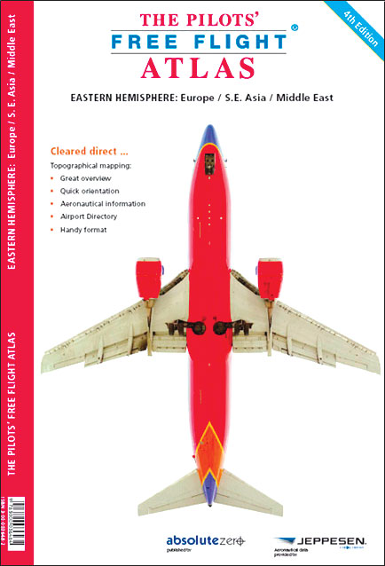
Pilots Atlas - Europe (4th Edition)
Pooleys stock code: BTC039
Big Changes: Completely new cartography | Completely new aeronautical data | new airport directory | new overview maps | new Captain's Corner | Expanded Area 16 additional pages cartography | now 224 pages content | 158 pages maps | 39 pages Captain's Corner 27 pages overviews | complete Atlas is printed in colour with ICAO-codes, waypoints, VOR's, NDB's, etc. | restricted, prohibited and danger areas | High quality, foiled cover | size 20 x 28cm / 8 x 11 inch.
£25.95/
£25.95 including VAT (Exempt) View details
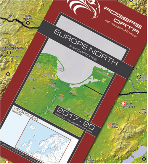
European Aerodromes North – Panorama Chart 1:2.500.000, 2017-2020 - Rogersdata
Pooleys stock code: ICH560
European Aerodromes North – Panorama Chart 2.500k 2017-2020: Panorama map on a scale of 1:2.500.000 | Overview of VFR, IFR, Civil & Mil. Aerodromes | Aerodromes with ICAO code | Colourful and accurate Urban areas | International borders | VFR an IFR aerodromes.
£31.75/
£31.75 including VAT (Exempt) View details
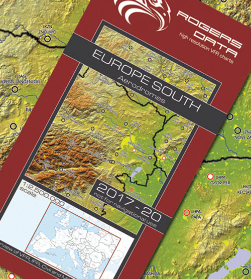
European Aerodromes South – Panorama Chart 1:2.500.000, 2017-2020 - Rogersdata
Pooleys stock code: ICH559
European Aerodromes South – Panorama Chart 2.500k 2017-2020. Panorama map on a scale of 1:2.500.000 | Overview of VFR, IFR, Civil & Mil. Aerodromes | Aerodromes with ICAO code | Colourful and accurate | Urban areas | International borders |VFR an IFR aerodromes.
£31.75/
£31.75 including VAT (Exempt) View details
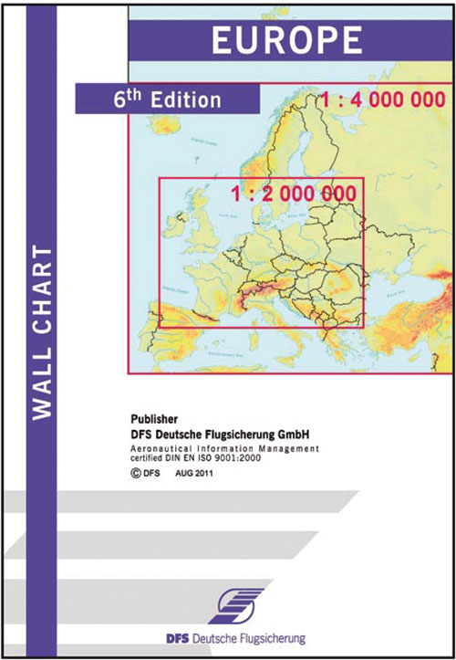
Airfield Guide Europe Wall Chart - 7th Edition
Pooleys stock code: CEU010
The Europe Wall Chart is an ideal chart for preparing flights to European destinations or alternates and calculating flight times, ranges and radius of action.
£34.95/
£34.95 including VAT (Exempt) View details